Vancouver-Granville Riding 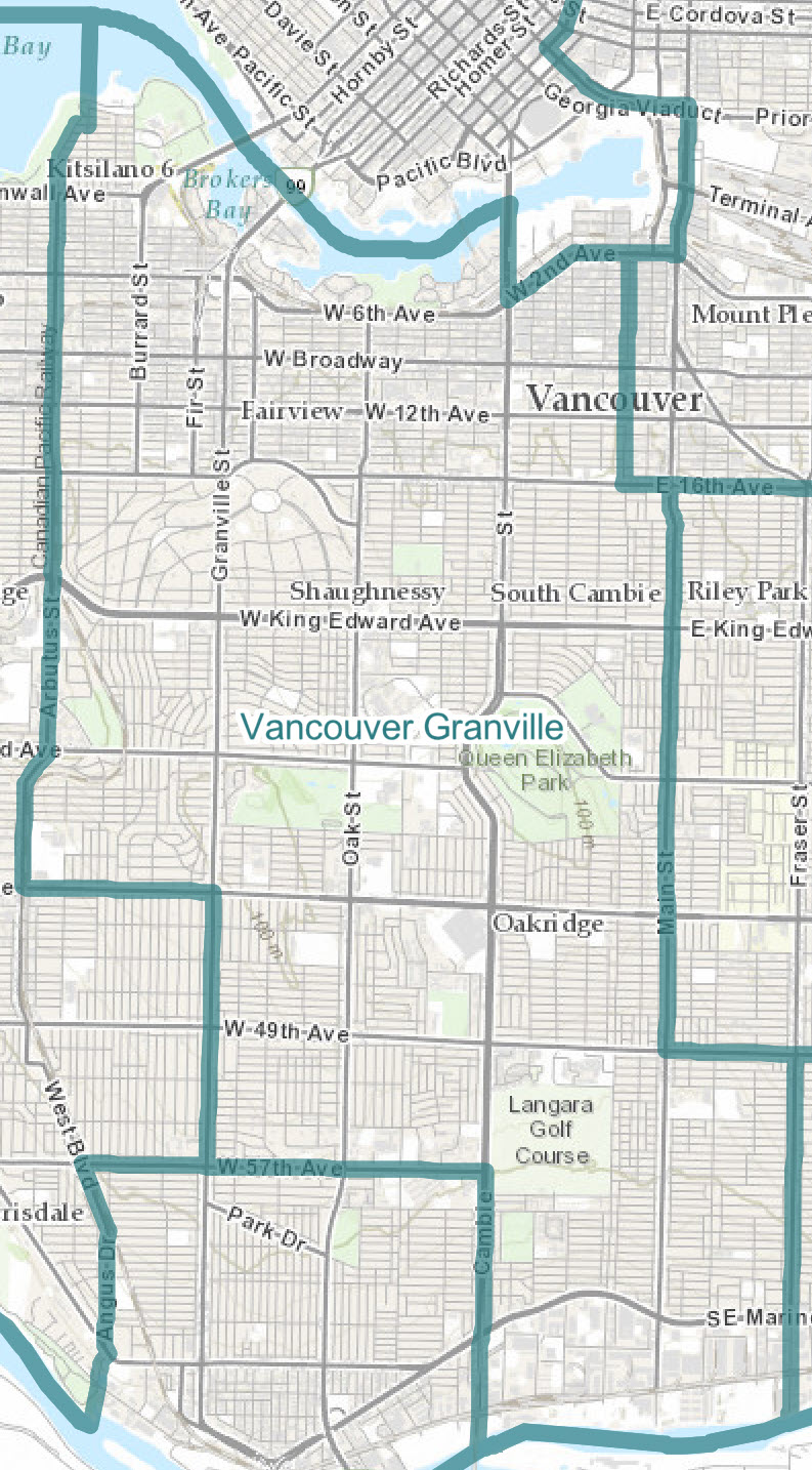
Vancouver Granville–Final boundaries
(Population: 116,798)
Consists of those parts of the Metro Vancouver Regional District comprising:
That part of the City of Vancouver described as follows: commencing at the intersection of West 2nd Avenue and Ontario Street; thence southerly along said street and its intermittent production to East 16th Avenue; thence easterly along said avenue to Main Street; thence southerly along said street to East 49th Avenue; thence easterly along said avenue to Fraser Street; thence southerly along said street and its production to the southerly limit of said city; thence generally westerly along said city limit to the southerly production of Cambie Street, that being a point in the Fraser River at approximate latitude 49°12'14"N and longitude 123°07'03"W; thence northerly along said production and Cambie Street to West 57th Avenue; thence westerly along said avenue to Granville Street; thence northerly along said street to West 41st Avenue; thence westerly along said avenue to West Boulevard; thence generally northerly along said boulevard and Arbutus Street to McNicoll Avenue; thence easterly along said avenue to Maple Street; thence northerly along said street and its production to the mouth of English Bay at approximate latitude 49°16'56"N and longitude 123°09'00"W; thence southeasterly along said bay to False Creek; thence southeasterly and northeasterly along False Creek to Cambie Bridge; thence southerly along said bridge and Cambie Street to West 2nd Avenue; thence northeasterly and easterly along said avenue to the point of commencement.
|